Energy & Renewables Portfolio

Greenlink Transmission Corridor – Nevada
WMK is providing survey services for a 700+ mile transmission line project supporting Nevada’s renewable energy goals. Our scope includes project control for LiDAR surveys, cadastral surveys, verification of aerial mapping data, preparation of legal descriptions, and easement mapping. The project spans public, private, and tribal lands, as well as state highway and railroad crossings.
Challenge: Discovered conflicting survey records and “double corners” in township boundaries due to historic survey errors, requiring detailed retracements and coordination with the BLM to resolve discrepancies before easement documentation.

Lincoln County Solar Project – Nevada
WMK provided full survey services for a large-scale solar development spanning over 7,000 acres across two parcels. Services included boundary surveys, ALTA/NSPS Land Title Surveys, aerial topography, preparation of a Division of Large Parcels (DLP) map, legal descriptions, and exhibits. The work also involved surveying all BLM rights-of-way and easements across 14 sections along the Lincoln–Clark County line and the Nevada–Arizona state border.
Challenge: Research revealed a BLM right-of-way scheduled for closure in 30 years, utilities located without recorded easements, and easements that did not fully cover existing infrastructure.
Resolution: WMK coordinated with utility companies, the City of Mesquite, and Lincoln County to establish new easements, ensuring all infrastructure was properly documented and legally protected.

Pahrump & Johnnie Corner Substation – Nevada
WMK provided boundary surveys, ALTA/NSPS Land Title Surveys, aerial topography, subsurface utility engineering (SUE) mapping, and site control for two substations supporting WMK's 164-mile 230kV transmission system upgrade project. Work included monument searches, digital terrain model creation, and setting boundary monuments with recorded surveys in compliance with state law.
Conflicts & Resolutions:
Historic Survey: At the Johnnie Corner site, the original 1880s survey monuments could not be located. WMK applied Bureau of Land Management (BLM) procedures for re-establishing lost corners.
Parcel Overlap: At the Pahrump site, research uncovered a 20-foot parcel overlap into an existing subdivision. WMK identified it as a potential junior-senior rights conflict, which could have resulted in a loss of recorded deed area for either party. The affected parcel was ultimately withdrawn from the project, preventing further dispute.
Public Works & Infrastructure

Lakemoor Infrastructure – Henderson, NV
WMK performed boundary, topographic, and alignment surveys for approximately 1,150 acres along Lake Mead Parkway near Lake Las Vegas. Work included recovery of 1942 NDOT concrete monuments, dependent resurveys of PLSS monumentation, and research of BLM, NDOT, and Bureau of Reclamation records.
Conflict: Multiple recorded private surveys and agency records conflicted on right-of-way geometry, including differences in curve radii and alignment.
Resolution: WMK collaborated with the City of Henderson surveyor, NDOT right-of-way staff, and other stakeholders to agree on right-of-way locations, enabling the subdivision to proceed without delay.

Lake Mead Blvd. – Losee to Simmons Street Rehabilitation – Las Vegas, Nevada
WMK provided control, boundary, and topographic surveys for 2.06 miles of roadway rehabilitation, including ADA upgrades, median replacements, and utility improvements. Work involved preparing deeds, legal descriptions, ROW maps, and validating aerial data against field surveys.
Conflict: An 11-foot right-of-way gap was discovered due to a historic plat error, creating overlapping and irregular ownership descriptions.
Resolution: WMK’s research identified the source of the error, coordinated findings with the City Surveyor, and supported a quiet title action to formally resolve ownership and ROW discrepancies.
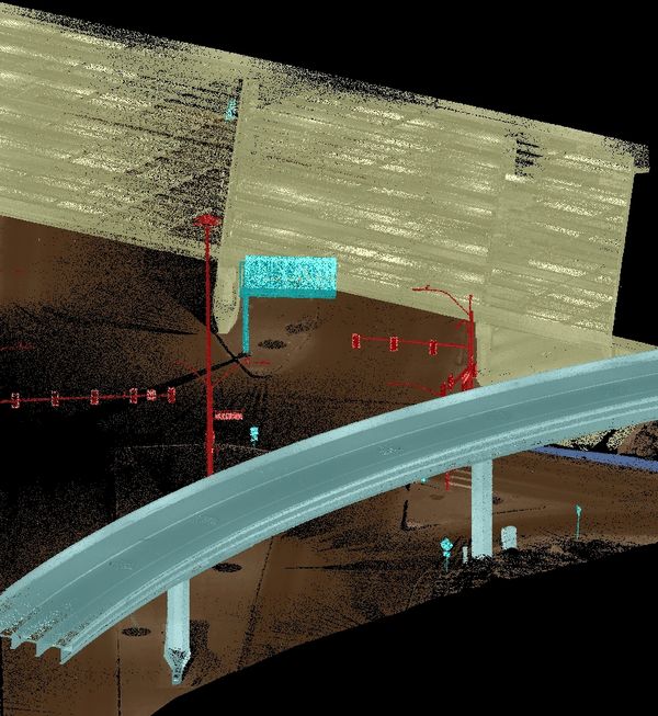
NDOT NEON Final Design Phase 2 – Las Vegas, NV
WMK conducted cadastral and topographic surveys along a highly developed corridor, including boundary verification, right-of-way analysis, and high-accuracy 3D scanning of the Sahara Avenue flyover and Charleston bridge.
Conflict: Of 23 NDOT “M” control points searched, only 11 met positional tolerances; a 30-foot right-of-way discrepancy was found near Western Avenue.
Resolution: WMK performed additional control recovery, network adjustments, and deed analysis to correct the ROW. Coordinated traffic control to safely complete scanning and delivered verified baselines, surface models, and ROW maps to support final design and acquisitions.
Private Development

Skye Canyon – Las Vegas, Nevada
Skye Canyon is a 1,700-acre master planned community in northwest Las Vegas, bisected by US-95. WMK performed boundary and ALTA/NSPS Land Title Surveys for the entire project, establishing horizontal and vertical control through a large-scale GPS static session spanning three full sections defined by BLM and private monumentation. BLM plats, field notes, and case files were researched to ensure survey accuracy.
Deliverables included three parent final maps creating the first 400+ acres for development, a 52-acre commercial subdivision map, and numerous residential final maps for the first 160 acres. WMK also prepared legal descriptions and exhibits for roadways, detention basins, phase boundaries, easements, park sites, and open space.
Conflict: Control monuments from both BLM and private records showed inconsistencies in position, requiring reconciliation before mapping could proceed.
Resolution: WMK adjusted the control network to satisfy both BLM standards and local development needs, enabling timely recording of the parent maps and preventing delays for subsequent builders.

Northgate Distribution Center – N Las Vegas, NV
Located on a 180-acre industrial site along Interstate 15, Northgate is the largest commercial master plan to begin construction in the Las Vegas Valley in the past decade, totaling 3.2 million square feet of industrial and warehouse space.
WMK performed a boundary and ALTA/NSPS Land Title Survey for the entire site, using a large-scale GPS static control network spanning four sections defined by both BLM and private monumentation. BLM survey plats, field notes, and case files were researched to ensure accurate control.
Mapping deliverables included two Commercial Subdivision Maps, two Parcel Maps, six Records of Survey, and numerous legal descriptions and exhibits for roadways, detention basins, easements, park sites, and open space.
WMK provided construction staking covering seven industrial buildings (largest over 800,000 sq ft) and extensive utility infrastructure. This included staking over three miles of NV Energy feeder lines through public streets and the UPRR right-of-way, along with water transmission and sanitary sewer lines.
Conflict: Overlapping and inconsistent right-of-way descriptions were encountered along feeder line routes.
Resolution: WMK resolved over three miles of centerline and ROW geometry before staking, preventing construction delays and utility conflicts.